2026
The GPS that talks to Google Earth
A USB GPS receiver, Google Earth wanting a speed the receiver can’t keep up with, and a driver Windows refuses: I wrote an app that configures it, shows map and satellites, and feeds the position to Earth.
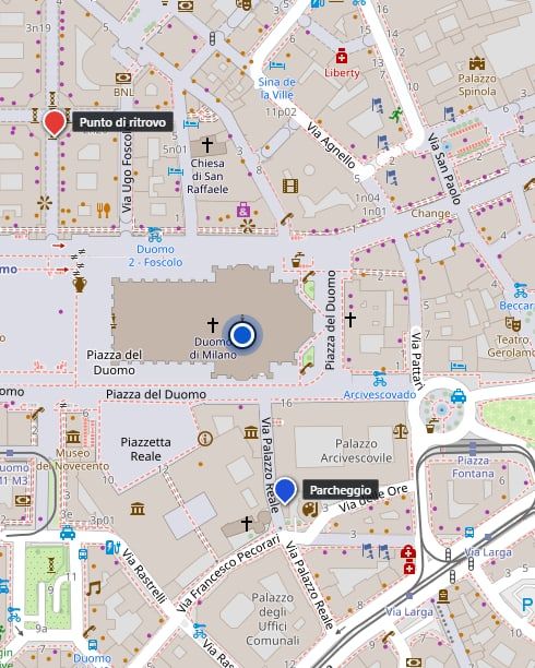
I bought a GPS receiver for a few euros, the kind you plug in with a USB cable, with the antenna at the end of a two-metre wire. Inside is a u-blox chip from the M10 family, which can listen to several satellite systems at once. I wanted it for something simple: watching my position move in Google Earth.
The wrong speed
Google Earth Pro reads the GPS from a serial port and expects the receiver to talk at 4800 baudThe speed of a serial port: how many signals a second travel down the wire. The talker and the listener must use the same one., that is 4800 signals a second: the speed of old receivers. Mine talks at 115200 by default, and when I slowed it down to 4800 it wasn’t stable. Probably because the sentences it sends, with every constellationA family of navigation satellites: GPS is the American one, Galileo the European, GLONASS the Russian, BeiDou the Chinese. switched on, are too many for such a narrow pipe.
So I thought of a program in the middle: it talks to the receiver at its own speed, and hands Earth only what it needs.
A driver Windows doesn’t want
The classic way is a virtual COM port: two ports linked to each other inside the computer, the program writes to one and Earth reads from the other at 4800. But it needs a driverThe small program that teaches Windows how to talk to a piece of hardware, even a pretend one like a virtual port.. The most used free one, com0com, installs on this computer and then Windows blocks it with a signature error, because I have Memory Integrity switched on, a protection I didn’t want to turn off for a GPS. The ones that work are paid.
So I changed my mind: instead of pushing the data to Earth, I made Earth come and get it. Earth can reload a file every second from an address, and the program runs a small server that lives only inside my computer and gives it, every second, a file with the position, the track and the points I’ve marked. No driver, no speed to respect.
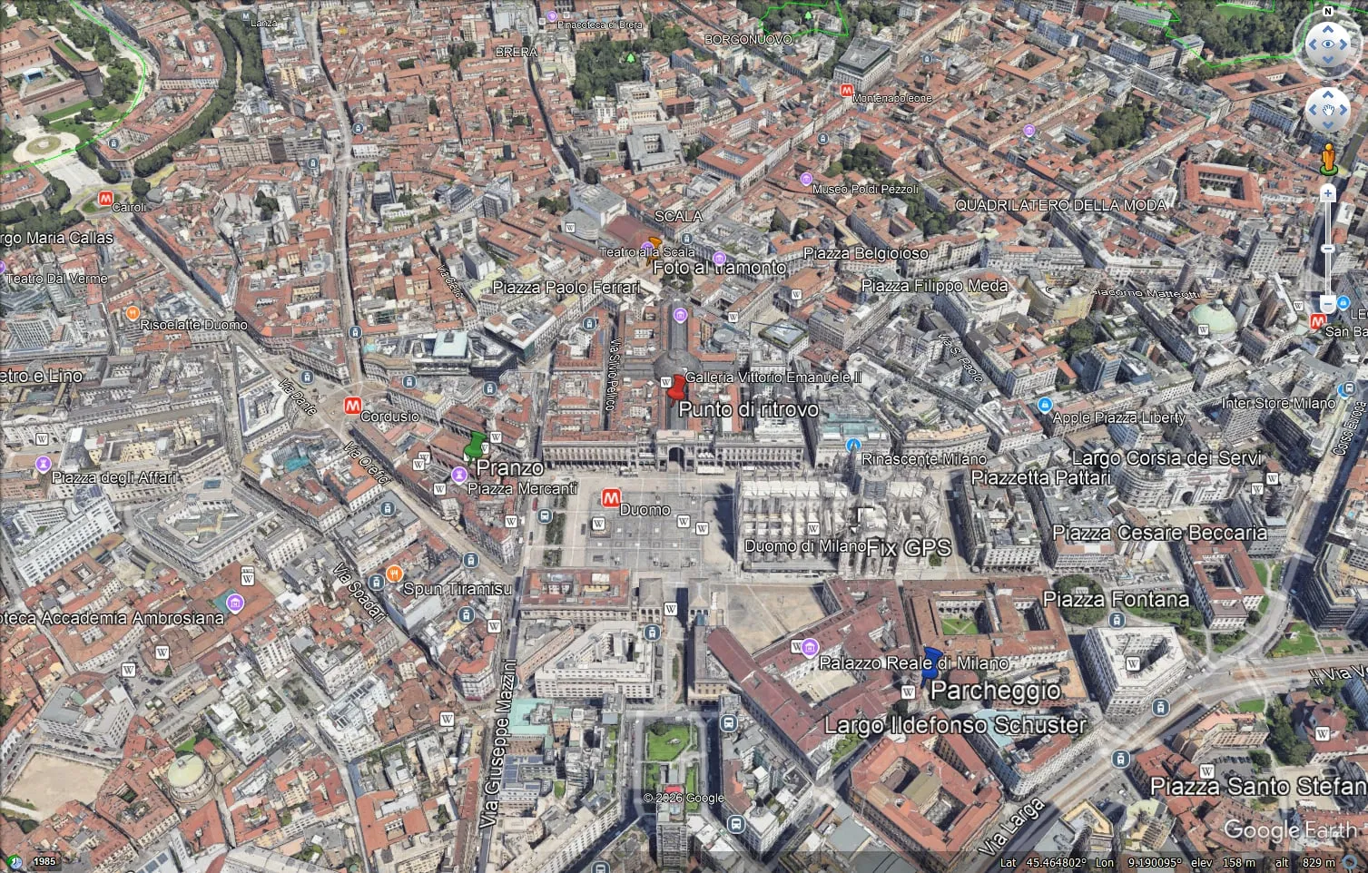 Google Earth Pro following the position and showing the points. The position is a test one, in front of Milan cathedral.
The banner inside Earth Pro says that from 25 June 2027 it will no longer be possible to download it for computers: for now it works, and the program doesn’t depend on it.
What it does today
Once the program in the middle existed, I realised it could do much more than pass data along, and it became a Windows app with everything you need when you work with positions.
- It finds the port and the right speed by itself, and reconnects if I pull the cable.
- It shows the map (road, topographic or satellite) and keeps it in memory, so it works where there is no network.
- You can mark points, each with its own name and colour, from the current position, by typing coordinates or with a right click on the map. Then you pick a point and the app tells you how far it is, in which direction and when you’ll get there.
- It records tracks in GPXA file format for GPS routes: a list of points with position, altitude and time. Almost every maps app can read it.: you can start, pause, stop and load any track, with distance, times, speed, climb and an elevation profile.
- It has a light and a dark theme, because in a car, in the sun, the dark one is unreadable.
- It checks by itself whether a new version is out and updates.
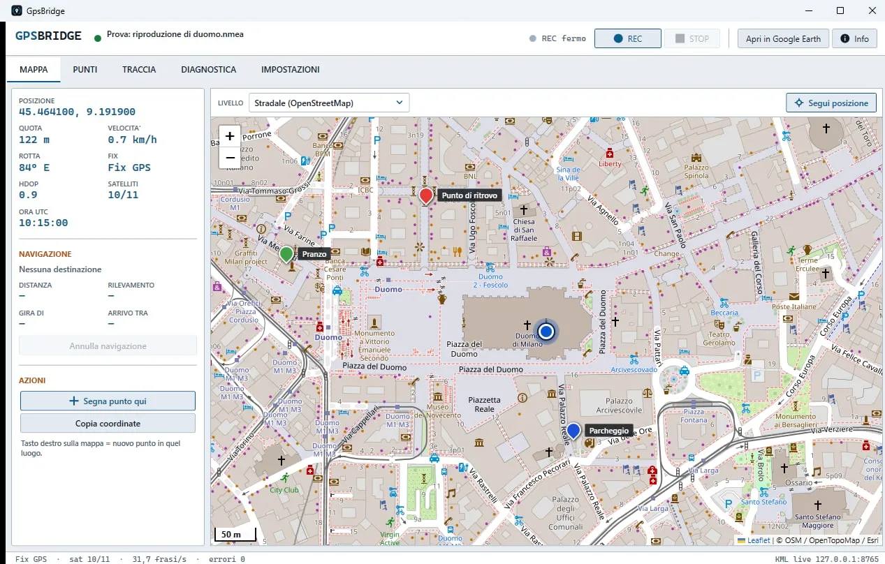 The map, with the position and the points.
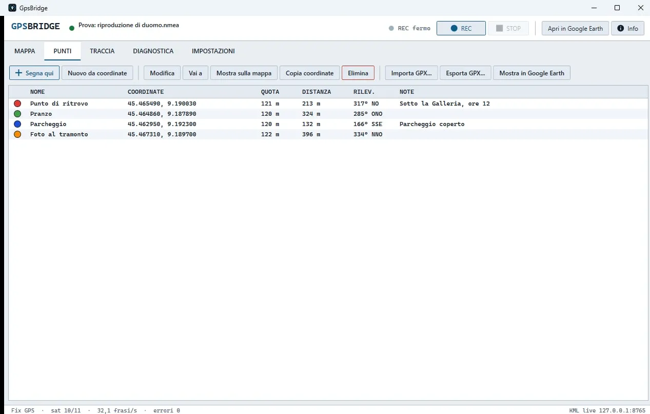 The points, with colour, name, distance and direction.
How many satellites, really
I wanted “every satellite unlocked”. The chip can use GPS, Galileo, GLONASS and BeiDou, and the app switches them on. Yet on the receiver I only saw GPS satellites. I asked the chip, and found out it can use only three at a time: if you switchA box with lots of network sockets: it links wired devices together, like a power strip for network cables. four on, it quietly falls back to GPS alone.
Now the app reads this limit from the chip, switches on GPS, Galileo and GLONASS (BeiDou can be chosen in place of one of the three) and writes it on screen, so there is no doubt left.
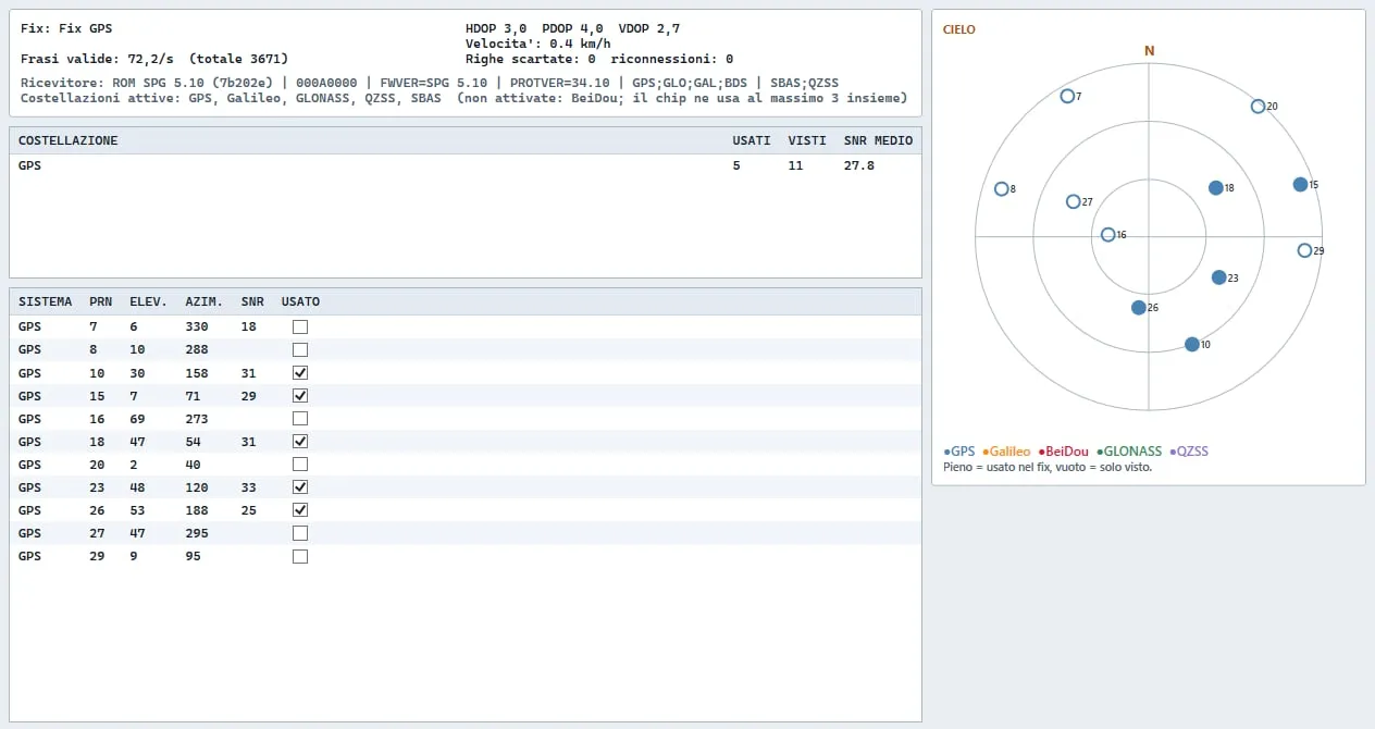 The diagnostics from the real receiver, indoors: only GPS satellites show up. Galileo and GLONASS are on, but I haven’t seen them appear yet: I’m waiting for the open air.
What I learned
That “on” doesn’t mean “in use”: to know what a device is doing you have to ask it, not trust what you wrote to it. That a Windows protection can bring down a whole plan, and that often the right way is another one, not getting around it. And that on the first day the public site was missing half of the program: a rule meant for Macs, in the file that tells Git what to ignore, mistakenly excluded the whole app folder. I noticed it by downloading the project from scratch, the way anyone would.
I made the app with the help of a programming assistant, Claude Code: it wrote the code, I decided what was needed and tested everything on the real receiver.
Where to find it
It’s free, for Windows 10 and 11: the code and the installer are on GitHub, in the Releases section.